Objectives
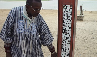
OPIDIN (Outil de Prédiction des Inondations dans la Delta Intérieur du Niger) is a tool developed for the Inner Niger Delta to predict the level and the timing of the flood peak as well as the maximal flood extent
read more
From August up to and including October OPIDIN predicts the height and timing of the maximum flood in the Inner Niger Delta (FLOOD FORECAST) and gives a map of the flooding of the delta at the peak of the flood (FLOOD VIEWER).
read more
The flooding of the Inner Niger Delta depends on the river flow of the Niger and Bani Rivers, which in turn depend on the rainfall in the Upper Niger Basin. OPIDIN provides regularly updated information on recent rainfall in the Upper Niger Basin and a rainfall forecast, all based on satellite information.
read more
In this section background information is given on OPIDIN. A snapshot of examples of the application of OPIDIN is given, and how it serves as Early Warning System. Next we provide information on how communities in the delta adapted to water management in the past as well as a snapshot of examples of OPIDIN as Early Warning System. This section also contains the technical background of the tool.
read more

The annual peak and extent of flooding is essential to the communities in the delta. Communication is done via the current website and weekly bulletins. These bulletins are used by radio stations in the Inner Niger Delta, broadcasting in several languages. They inform about the situation of the flood and the prediction for the coming weeks during the period August-November.
read more

OPIDIN (Outil de Prédiction des Inondations dans la Delta Intérieur du Niger) is a tool developed for the Inner Niger Delta to predict the level and the timing of the flood peak as well as the maximal flood extent
read more
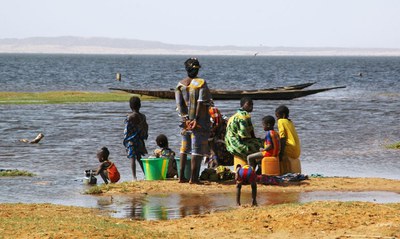
The seasonal flooding of the Inner Niger Delta is the lifeline for communities and biodiversity in this flood-dependent ecosystem and economy. Fishermen, rice farmers and pastoralists time their (socio-)economic activities to the flooding pattern in time and space. That has been the main motivation to develop a practical tool to predict the flooding in the Inner Niger Delta
read more
OPIDIN has been developed through close cooperation between the Direction Nationale de l'Hydraulique, Wetlands International Mali and Altenburg & Wymenga ecological consultants, with the support of the Dutch embassy in Mali.
read more